
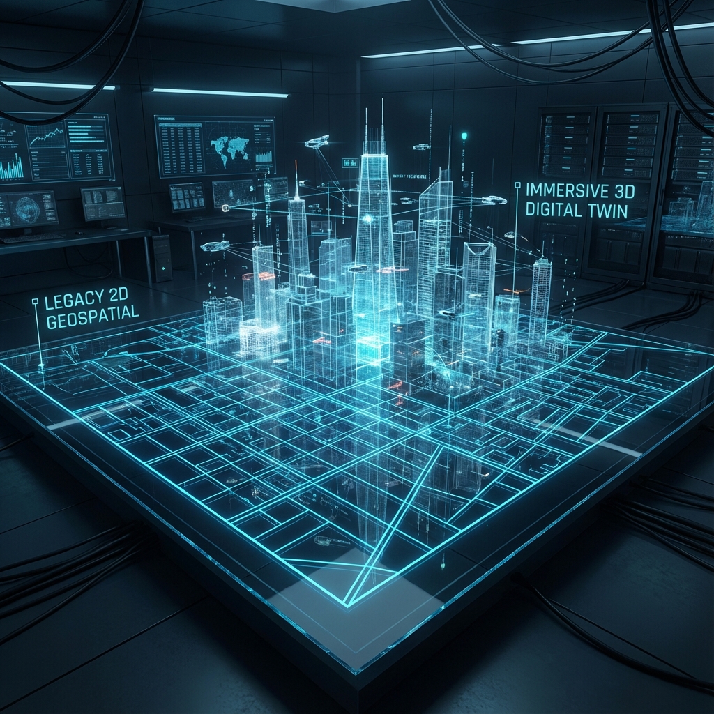
In the world of infrastructure development, precision and perspective make all the difference. Traditional 2D maps have served us well, but as projects grow more complex and interconnected, the need for immersive and intelligent visualization has become undeniable.
That’s where Space, Blocktwin’s 3D geospatial platform, steps in — transforming how engineers, planners and decision-makers explore, design, and collaborate.
Why 3D over 2D?
While 2D maps capture surface-level data, 3D visualization brings depth, scale, and realism to every project. It helps teams move beyond static blueprints to dynamic, data-rich environments that mirror real-world conditions.
In a 3D space, users can:
- Zoom, rotate, and explore any structure from multiple angles.
- Identify hidden spatial patterns or risks early in planning.
- Make faster, more informed decisions through realistic simulation.
Key Features That Redefine Infrastructure Design
Interactive Renders
Experience your project like never before — walk through digital models, toggle data layers, and simulate environmental conditions such as lighting or flood impact.
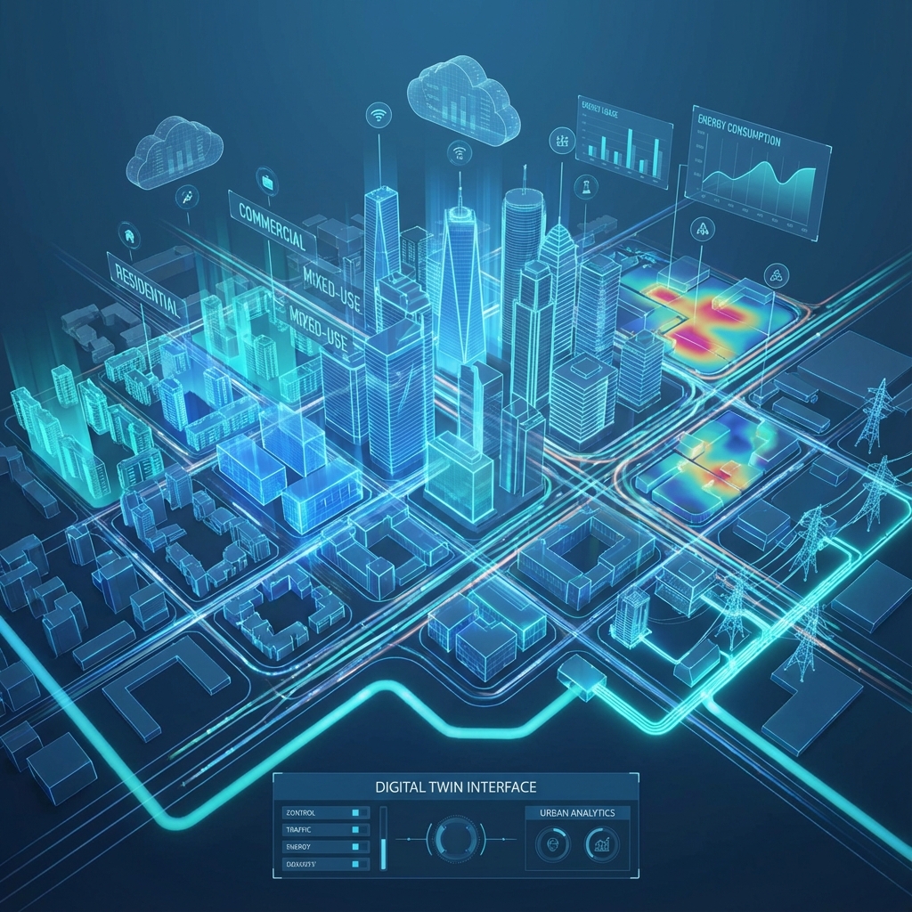
Seamless Collaboration
With cloud-based access, multiple stakeholders — from engineers to government agencies — can visualize and interact with the same model in real time. This bridges the gap between technical teams and decision-makers.
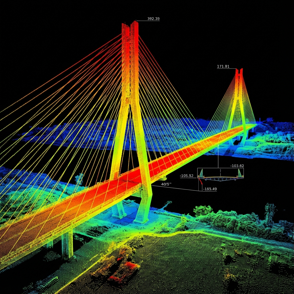
LiDAR Integration
Space seamlessly incorporates LiDAR and photogrammetry data, enabling centimeter-level precision in terrain and structure mapping. From elevation models to vegetation density, every detail is captured with unmatched accuracy.
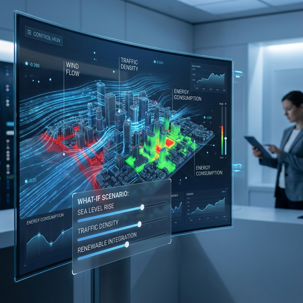
Custom Simulations
Test “what-if” scenarios instantly. Whether it’s a bridge under load or an urban expansion plan, Space lets teams run simulations that predict real-world outcomes.
Real-World Impact: Bridge Monitoring Case Study
A leading infrastructure agency used Space to monitor a high-traffic bridge’s structural integrity.Using 3D LiDAR data and AI-driven analytics, they created a real-time digital twin of the bridge,tracking minute changes in geometry and stress over time.

Result:
- Reduced inspection time by 45%
- Early detection of structural wear
- Improved safety and maintenance scheduling
Experience the Future of Geospatial Intelligence
With Space, you’re not just visualizing — you’re experiencing your project in motion. Transform static plans into living models that evolve with data, collaboration, and AI-driven insight.
Try Space Today